Friday, November 6, 2009

TD Ida Morning Update

10:00 AM Update

Longitude: 15.0N Latitude: 84.0W

Maximum Sustained Winds: 35 mph

Movement: North at 7 mph

Minimum Central Pressure: 1007 MB


Ida is now a tropical depression. She is currently over eastern Honduras and should emerge back into the Atlantic by tonight. If she holds together and her core structure is not heavily damaged, Ida will restrengthen into a tropical storm fairly quickly and possibly reach hurricane status with time. Presently, there is moderate shear in the Gulf of Mexico (GOM) and that might inhibit any rapid strengthening from occurring, but the possibility still exists.


Currently, the models are in a good agreement for the next 24-48 hours. After that time frame, they begin to disagree. Some models want to take Ida into the central GOM by Tuesday while others want to take Ida towards the NE and bring her close to Florida. The latter is what the NHC is thinking are the more reliable solutions to follow at this point due to the historical climatology of the month of November. The reason for the possible bend towards Florida is due to a cold front that will be arriving by early next week. It is expected that Ida will get picked up by that front and brought into Florida. It is not known how strong will Ida be at that point, but everything points to a stronger storm in a few days. In fact, Ida could line-up with shear later in the forecast. What does that mean? It means that at some point in the forecast track, Ida could be moving in the same direction as the shear is blowing. Experts say this could actually help Ida strengthen further. Let's see what actually occurs. As you will see in the link below, the 5 day cone does show more of a bend towards Florida than it did yesterday.


At this point, we have to wait and see for three things: (1) in what shape will Ida emerge off the coast of Honduras. (2) how will the shear affect Ida once it reaches the GOM. (3) when will the front pick up Ida and where will Ida be at that point. All of the points listed above are to occur in that order. Over the weekend, we should keep a very close eye on Ida and see what transpires. I will try to send an update at some point Saturday. Have a great weekend !!


TD Ida - 5 Day Cone

Thursday, November 5, 2009

Hurricane Ida Morning Update

Latitude: 12.8N Longitude: 83.4W

Maximum sustained winds: 75 mph

Present movement: NW at 7 mph

Minimum central pressure: 987 mb


TS Ida became a Hurricane Ida this morning and she is very close to the coast of Nicaragua. Although she is a minimal hurricane, winds gusting as high as 85 mph along with life threatening flooding in the region. The current thinking is that Ida will traverse Nicaragua and exit through Honduras by 1 am Saturday. That is a lot of time to be inland and it can seriously affect the structure of Ida. She is expected to emerge as a tropical depression by that time and make it back to tropical storm status by 1 am Sunday. In between 1 am Monday and 1 am Tuesday, Ida might clip the eastern tip of the Yucatan Peninsula. Multiple models bring Ida into the Gulf of Mexico in a week. It is still early to say where and what Ida will do, but she does need to be watched in the coming days. An expert I read, thinks that Ida might not enter Nicaragua right away, slow down a bit, hug the coast, and then enter, but not spend too much time inland. If that occurs, Ida will not lose much of her punch. The atmosphere and time will tell. Stay tuned.


 5:00 AM 5-Day Cone


Wednesday, November 4, 2009

TD #11 Is Born

An area of low pressure in the southwestern Caribbean has become better organized this morning. As of 11:00 AM, the National Hurricane Center has declared this system as Tropical Depression #11. Bursts of thunderstorms are occurring near the center with pronounced banding features developing also. The NHC has said that they will not be surprised if this system is already a Tropical Storm, but will hold off on taking that step until the Hurricane Hunters investigate TD #11 later this afternoon to give a better estimate of the actual winds.


The current thinking on the future track of TD #11 is that steering currents will remain weak during the next 5 days. Models do not have a good handle of TD #11, but some are saying that the depression will drift into Nicaragua and then re-emerge out the coast of Honduras. At that point, the system seems to curve. Considering the high uncertainty regarding the 5 day cone, don't put too much into the first few 5 day cones. They never stay the same. Once the depression has developed into a tropical storm, give it a couple of days so the models can get a good handle of the system.


I will post again later today with important information on the Hurricane Hunter mission and if TD #11 is updated to Tropical Storm Ida.


Friday, September 18, 2009

Ex-Fred

What's left of Fred is still alive and need to be watched carefully.
Ex-Fred was located about 820 miles east of Florida moving WNW at around
14 mph. Currently, there is about 20 knots (23 mph) of shear around
ex-Fred and satellite is showing thunderstorms firing back-up south of
the center. It is predicted that ex-Fred will be in the Bahamas by
Sunday and close or onshore of east Florida (Vero Beach to Miami-Dade).
Ex-Fred will be moving into an area of favorable conditions as early as
tomorrow continuing into Sunday and Monday as it approaches the Bahamas
and Florida.

Even if ex-Fred does not regenerate into a tropical depression or storm,
heavy rainfall and gusty winds will be felt by Monday and continuing
into Tuesday. Some of the models think that ex-Fred might be delayed and
arrive Tuesday or Wednesday. Either way expect rain and wind around
Monday/Tuesday. Intensity models say that ex-Fred will regenerate into a
tropical storm again within the next 24 hours and forecast it to be a
50-55 mph tropical storm by Sunday/Monday and make landfall by late
Tuesday as a 60-65 mph tropical storm in eastern Florida.

It is going to be very tough to know for sure if will eventually
regenerate. I will not be surprised if ex-Fred does regenerate this
weekend. I say it is 50/50. Models are currently not in agreement on
where landfall will occur. Anyone living between Vero Beach and
Miami-Dade should watch carefully what happens with ex-Fred. Hurricane
Hunters are expected to fly into ex-Fred tomorrow afternoon to offer
more information for a better outlook.

I will watch this closely and advise over the weekend.

*** This communication has been sent from World Fuel Services
Corporation or its subsidiaries or its affiliates for the intended recipient
only and may contain proprietary, confidential or privileged information.
If you are not the intended recipient, any review, disclosure, copying,
use, or distribution of the information included in this communication
and any attachments is strictly prohibited. If you have received this
communication in error, please notify us immediately by replying to this
communication and delete the communication, including any
attachments, from your computer. Electronic communications sent to or
from World Fuel Services Corporation or its subsidiaries or its affiliates
may be monitored for quality assurance and compliance purposes.***

Friday, September 11, 2009

Fred - Teaching Moment

Good Afternoon !!!!!!!!!! I have decided that what is going on with Hurricane Fred far far away from land should be a great teaching moment for everyone.


On Monday, September 7 at 5:00 PM, the track of Fred looked like this after the 1st advisory:
 
Loading Storm Graphics Loops
 

Why was Fred supposed to take that track? Well the simple answer is because the high pressure above Fred was going to be weakened by a trough of low pressure making its way across the Atlantic. The breakdown of the high pressure ridge (wall) and the influence of the trough (pull), Fred is allowed to take a more NW then north track because his "wall" will be weak and it will be "pulled".


On Tuesday, September 8 at 5:00 PM, Fred's track looked like this on after the 5th advisory:
 
Loading Storm Graphics Loops


If you notice, the track illustrates a harder "pull" to the north. Two reasons why: (1) the trough of low pressure is stronger than they thought. (2) Fred was almost a hurricane at that point. When a storm is stronger is feels the effect of a trough a lot more that a weaker one. On the previous track, Fred's path showed a slower turn to the NW and north AND it is hinting of a possible turn to the WNW.


On Wednesday, September 9 at 5:00 PM, Fred's track looked like this on after the 9th advisory:
 
Loading Storm Graphics Loops


There is the westward motion I mentioned before. Why the change? Well, for starters, the trough is still there for the first part of the advisory, but towards the end of it the high pressure builds back in and is steers Fred more west. In the middle of the track, you would see that there are three dots  that loo like they are on top of each other. That is an indication that the steering currents (what move the storms) will break down and Fred will meander out there.


On Thursday, September 10 at 5:00 PM, Fred's track looked like this on after the 13th advisory:
 
Loading Storm Graphics Loops


Look at the track. You can't even see the first few dots because Fred is not even moving. Why? The steering currents broke down completely and there is nothing to "driving" the storm a certain direction. Towards the end of the track the westward movement is more distinguished. At this point, the track shows that the high pressure system above Fred will build back in in a few days and steer Fred towards the west.


Today's track looks like this:
 
Loading Storm Graphics Loops


Still meandering (as 11:00 AM Fred's movement was 1 MPH) and then turning towards the west in a few days.


I just want to show you guys that anything can change/happen with a tropical system. Just because the NHC says it is going to turn left in 5 days doesn't really mean that. Not because they don't know what they are saying, but because the atmosphere changes by the minute. When you are dealing with troughs and high pressures, there is always the possibility of the trough and/or the high pressure being weaker/stronger than expected in the days to come.


Fred is scheduled to weaken and become a remnant low in a few days, non tropical. Some models are hinting that the remnants of Fred will make it into the Bahamas in 10-12 days. Will Fred become as weak as the NHC currently says? Will he weaken only to a tropical depression? Shear is really taking its toll on Fred and that, along with cooler waters, will weaken Fred. Depending on Fred's structure in the coming days, those questions can possibly be answered. Until then, it is all speculation. I will keep an eye on this and inform all of you of any developments.

Friday, September 4, 2009

Morning Tropical Update

As of last night 11 PM, the National Hurricane Center will no longer issue advisories on the tropical depression formerly known as Erika. It has been ripped apart by shear before even getting to HispaƱola. If Erika decides to regenerate, which the NHC currently gives a less than 30% chance of developing, the NHC will resume with the advisories. For now, R.I.P. Erika.


NEXT !!


Well since we are reaching the peak of hurricane season, September 12, we have another wave to track across the Atlantic for the next two weeks. A strong and huge wave near the Cape Verde islands has the potential to develop in the coming days. The NHC gives this wave a less than 30% chance of developing. The percentage is low because it emerged of the African coast early yesterday. Maybe by next week we could have a TD in the Atlantic. Time will tell. Have a great long weekend !!


Thursday, September 3, 2009

Tropical Storm Erika Update

There is not much that can be said about Erika at this moment. She is on life-support and the thinking is that she may not recover, but she has shown us that she is a fighter. We have seen everything occur with this storm, so nothing would surprise me anymore. The Hurricane Hunters have been flying around her for a few hours now and they have not found winds within Erika to support her tropical storm status. She most likely will be downgraded to a tropical depression at 5 pm. Could things change in the future for Erika regarding her structure, intensity, and atmosphere surrounding her? Yes, but that is not the thinking. It will be interesting to see what Erika does when she leaves Puerto Rico and Hispañola behind and approach the Bahamas. For now, expect to get rain and gusty winds around Tuesday in South Florida due to the remnants of Erika. I won't let my guard down until two things happen: (1) she dies (2) she passes my latitude/longitude. Since neither of those two things have occurred, I'll keep my eye on her. Another update tomorrow afternoon. Have a great night.

*** This communication has been sent from World Fuel Services
Corporation or its subsidiaries or its affiliates for the intended recipient
only and may contain proprietary, confidential or privileged information.
If you are not the intended recipient, any review, disclosure, copying,
use, or distribution of the information included in this communication
and any attachments is strictly prohibited. If you have received this
communication in error, please notify us immediately by replying to this
communication and delete the communication, including any
attachments, from your computer. Electronic communications sent to or
from World Fuel Services Corporation or its subsidiaries or its affiliates
may be monitored for quality assurance and compliance purposes.***

Wednesday, September 2, 2009

Tropical Strom Erika Update

I really don't have much of a real update. At this point, it is wait and
see what happens with Erika. Some models say Erika will be a Cat. 3
hurricane while others have it as a weak tropical storm. Others want to
take her through Puerto Rico and back out to the ocean. Which one is
correct? The NHC track of Erika has been shifting to the left since
yesterday's 5 pm advisory. The Hurricane Hunters are currently flying
through Erika and have found winds up to 50 mph. I believe that the NHC
will upgrade Erika to 45-50 mph based on that data. She is struggling to
survive and putting up a good fight. Shear is trying to kill her, but
not yet. In the last few hours it seems that thunderstorms are trying
again to get organized around the center. I have read that made the
center will be moved down and to the right of where it is now. That is
one of the reasons why Erika has weakened - she has multiple centers. It
seems that maybe the one SE is the more dominant one. Time will tell. I
will send out another update later tonight if needed. If not, expect one
at about the same time as today.

*** This communication has been sent from World Fuel Services
Corporation or its subsidiaries or its affiliates for the intended recipient
only and may contain proprietary, confidential or privileged information.
If you are not the intended recipient, any review, disclosure, copying,
use, or distribution of the information included in this communication
and any attachments is strictly prohibited. If you have received this
communication in error, please notify us immediately by replying to this
communication and delete the communication, including any
attachments, from your computer. Electronic communications sent to or
from World Fuel Services Corporation or its subsidiaries or its affiliates
may be monitored for quality assurance and compliance purposes.***

Update at 4:00 pm

I will send out an update at 4:00 pm regarding tropical storm Erika.
Thank you for your patience.

*** This communication has been sent from World Fuel Services
Corporation or its subsidiaries or its affiliates for the intended recipient
only and may contain proprietary, confidential or privileged information.
If you are not the intended recipient, any review, disclosure, copying,
use, or distribution of the information included in this communication
and any attachments is strictly prohibited. If you have received this
communication in error, please notify us immediately by replying to this
communication and delete the communication, including any
attachments, from your computer. Electronic communications sent to or
from World Fuel Services Corporation or its subsidiaries or its affiliates
may be monitored for quality assurance and compliance purposes.***

Tuesday, September 1, 2009

Tropical Storm Erika Is Born

As of 5:00 pm, invest 94L became tropical storm Erika. Erika is located at 17.2N 57.3W and she is traveling WNW at 9 mph with winds at 50 mph. Erika is expected to be by Friday afternoon north of Puerto Rico and a few hundred miles north of Haiti by Sunday afternoon. There are a lot of uncertainties with the track of Erika due to the same scenario of every year - high pressure and a trough. Currently, models are saying that a trough (takes storms out to sea) will create a weakness against the high (blocks storm from curving out to sea) over the storm. Once that occurs, the thinking is that Erika will curve out to sea. There are also those who say that the trough will not be strong enough and it will leave causing the high to build further west. Not good, but luckily that is not the current thinking. I wouldn't pay too much attention to where the models are saying Erika will travel through. They do not have any of the new information collected today by the Hurricane Hunters. That information will most likely make into the models 6-12 hours from now. Let's give the models some time to digest the info then see what they say. So for now, sit tight and listen to your local meterologists. I will have another update later tonight IF something changes. If not, expect an update after the 11 am update by the NHC.

Graphics below:

[Image of 5-day forecast and coastal areas under a warning or a watch]
Image Credit: National Hurricane Center

Image Credit: NOAA Satellite and Information Services

Image Credit: South Florida Water Management Division

Image Credit:

Tropical Storm Erika

The Hurricane Hunters have been flying into and across invest 94L. Winds as high as 48 mph have been found. Therefore, I expect the NHC to name invest 94L Tropical Storm Erika. I am curious to see the 5 day cone of "uncertainty". More info later.

Monday, August 31, 2009

Afternoon Update

Nothing new on Invest 94L. Currently, it is surviving considering it has shear around that is trying to disrupt it. It is lacking a COC (Center Of Circulation). Without that, this system won't develop. Once it does acquire a COC, it could possibly strengthen rapidly because 94L currently is in hot waters. I believe that by tomorrow morning we will have Tropical Depression #6. In the short term, the Antilles and Puerto Rico should monitor any developments occurring with 94L/TD #6 as it will be in close proximity in the coming days. In the long run, 94L/TD #6 might pose a threat to the Bahamas and the CONUS (COntinental United States). There are some ideas as to the future track of 94L/TD #6, but I would like to see how things "pan out" in the 12-18 hours. I don't like to speculate and would prefer to wait until more data is analyzed.

Also, the Hurricane Hunters are scheduled to fly into 94L tomorrow. This would be great because we need all the info we can get considering 94L looks like more than an invest. I will be back tomorrow, if nothing changes tonight, with a full update and more information about the future track of 94L/TD #6.

Thursday, August 27, 2009

Morning/Afternoon Tropical Update

Image Credit: National Hurricane Center


11 AM EST NHC Update:
Location: 27.5 North Latitude, 73.1 West Longitude.
Maximum Sustained Winds: 60 mph.
Movement: Northwest 13 mph.
Minimum Central Pressure: 1006 mb

Tropical Storm Danny continues to look disorganized this morning. The center continues to be exposed with the heaviest thunderstorms being several hundred miles east of the center. Despite its disorganization, Danny continues to generate strong winds, with the Hurricane Hunters reporting winds in the 55 - 60 mph range early this morning. Conditions around Danny should get a bit better between today and Friday for Danny to gain Cat.1 strength. A landfall in Cape Cod, eastern Maine, or Nova Scotia with 55 - 75 mph winds is a good bet. Currently, Cape Hatteras and Morehead City are out of the cone, but close enough offshore to keep monitoring Danny very closely. Farther north, Cape Cod and surrounding areas should also monitor Danny closely as he will be passing by on Saturday afternoon and a direct hit cannot be ruled out. On the current track, a direct hit is expected in Nova Scotia later in the forecast.

Please stay tuned to the blog for further details, but most importantly, follow the advice of your local meteorologists.

Invest 92L was born yesterday out of the blob in the picture I sent yesterday morning. Currently, the NHC gives the tropical wave a less than 30% chance of tropical development within the next 48 hours. At this moment nothing else can be said about the strong tropical wave because it is far out in the Atlantic Ocean.

My next update will be tomorrow morning.

Have a great day !!

Wednesday, August 26, 2009

Next headache ??

The models are not saying much about the wave below yet, but the NHC says there is a less than 30% chance of it becoming a tropical cyclone within the next 48 hours. It does look pretty impressive and conditions around it are favorable for development. I will keep an eye on the
models in the coming days to see if they start to pick up this wave and where should we expect it to go.

Morning/Afternoon Tropical Update

Here is the 11 am est Information on Tropical Storm Danny:
Location: 24.9 North Latitude, 70.3 West Longitude.
Maximum Sustained Winds: 45 mph.
Movement: West Northwest 18 mph.
Minimum Central Pressure: 1009 mb.

Tropical Storm Danny is located 445 miles east of Nassau, Bahamas and 775 miles from Cape Hatteras, North Carolina. Danny is expected to commence a general NW motion beginning today and continuing Thursday with a turn towards the NNW on Friday. Tropical storm force winds extend outward up to 140 miles from the center. On its current track, Danny's closest approach to Florida ranges between 400-450 miles off the coast anywhere between 8/27/2009 at 8:00 pm and 8/28/2009 at 8:00 am.

Danny is not expected to be a threat for Florida, but interests in the Carolinas and points northward along the eastern seaboard including Nova Scotia, again. By the time it reaches Nova Scotia, it is projected to be a Cat.1 hurricane, possibly a minimal Cat.2. Considering the current information, watches and warnings may be needed for the area of Morehead City and Cape Hatteras in North Carolina beginning today at the earliest 5 pm or the ultimate latest 5 am tomorrow morning. Things might change between now and tomorrow, but Danny will pass about 120 miles off the coast of Cape Hatteras on Saturday morning. As mentioned above, tropical storm force winds extend 140 miles so these winds will be felt in Cape Hatteras. More info to follow. Below is the forecast track for tropical storm Danny.

Monday, August 24, 2009

Morning Tropical Update

R.I.P Hurricane Bill !!

Happy 17th Anniversary Hurricane Andrew !!

Welcome to the World Invest 92L !!

We have a new area of disturbed weather to keep an eye one this week. It has been labeled Invest 92 L for investigational purposes. Currently, the tropical wave is located east of the Leeward Islands moving WNW. Models have shown that a storm will develop just before the Bahamas early this week and track away from Florida and up the east coast late in the week. The entire eastern seaboard should monitor this wave until it becomes clearer the path of Invest 92L. The National Hurricane Center has also designated this area "code yellow" which means it has a less than 30% chance of developing at this moment. I will keep everyone updated as the news changes.

Below is a picture taken by the Hurricane Hunters during one of their missions into Hurricane Bill. This picture was taken while in the eye.

Image Credit: Weather Underground - Dr. Jeff Masters Blog

Thursday, August 20, 2009

Morning/Afternoon Tropical Update

11:00 AM EST Hurricane Bill Update:

Location: 22.6 North Latitude, 61.7 West Longitude

Maximum Sustained Winds: 120 mph

Movement: Northwest at 18 mph

Minimum Central Pressure: 951 MB


A hurricane watch has been issued for the island of Bermuda. Bill is located 695 miles south southeast of Bermuda and hurricane conditions are expected in 36 hours. Bill has weakened a bit due to the eyewall becoming exposed on the southwest side, but he is expected to re-gain Cat. 4 strength by Friday considering he will be traversing the warmest waters yet . Bill has grown in size since yesterday's advisory. Currently, tropical storm force winds (34-73 mph) extend 260 miles from the center and hurricane force winds (74+ mph) extend 105 miles.


The current thinking from NHC has not changed. Hurricane Bill will come within 100-150 miles from the coast of New England. Residents and vacationers in Nova Scotia and Prince Edward Island should start preparing today for a hurricane strike on Sunday/Sunday night. Bill is expected to make landfall in Nova Scotia as a strong Cat.2/ weak Cat.3 (100-115 mph). There is the possibility that Bill's eye could pass offshore of the mentioned areas. Landfall or close call, very strong winds and rain will be felt in the areas mentioned above and preparation should commence for the worse.


I will have another update tomorrow morning. Have a great day !!

Wednesday, August 19, 2009

Morning Tropical Update

Here is the 11 AM EST On Hurricane Bill:

Location: 18.7 North Latitude, 56.3 West Longitude
Maximum Sustained Winds: 135 mph
Movement: West-Northwest at 18 mph
Minimum Central Pressure: 950 millibars

This morning's satellite shows Bill continues to have impressive symmetry and his eye is about 25-30 miles wide. Hurricane Hunters are inside Bill investigating him and the atmosphere surrounding him. An upper level low (ULL) and a trough of low pressure are the weather features that will create the weakness on the western side of the high pressure ridge. Models are forecasting that Bill will commence to turn northwest in about 2-3 days. The question is when will the turn occur. European models suggest that the turn will happen near 67 west longitude and two other models suggest that Bill will turn between 70-71 west longitude. The farther out in the forecast the wider the models get from each other. People in New England and points north show watch the track of Bill closely because the models continue to shift west (slightly) and every shift keeps bringing Bill closer and closer to brushing the coast. The NHC is NOT forecasting landfall in New England, but a small part is in the cone. On the other hand, Nova Scotia and Newfound Land need to watch the track of Bill much closely as it approaches because they are currently in the path of probably a weaker Bill at the end of the forecast track. Most likely by that time, Bill would be downgraded to a strong Cat.1 to a medium Cat.2 because the waters would be cooler farther north and he would be moving pretty fast.

There are still some minimal concerns regarding Bill's much anticipated turn. Atmospheric changes can occur at any time and IF the high pressure currently steering Bill get stronger and force Bill on a more westerly track and curve Bill out to sea later than anticipated. The NHC seems very confident on the scenario they have had for days now and I trust their thinking. Me personally, do not feel safe until Bill passes my latitude 25 north (Miami). Everything seems to point to Bill passing about 1,000 miles off the coast of Florida. Bill currently has a hurricane force (74+ mph) wind field that extends out 80 miles and tropical storm force winds (39-73 mph) extend 180 miles from the center. Also, swells as high as 12 feet should affect the Leeward Islands, Bermuda, and part of the eastern seaboard.


There are a few waves out there that need to be watched, but nothing imminent. I will keep my eye on them and let you guys know as soon as anything changes.

Have a great day !!

Tuesday, August 18, 2009

NHC update

Straight from the horse's mouth:
000
WTNT63 KNHC 190030
TCUAT3
HURRICANE BILL TROPICAL CYCLONE UPDATE
NWS TPC/NATIONAL HURRICANE CENTER MIAMI FL AL032009
830 PM AST TUE AUG 18 2009

...BILL BECOMES A MAJOR HURRICANE...

REPORTS FROM A NOAA HURRICANE HUNTER PLANE INDICATE THAT BILL HAS STRENGTHENED AND MAXIMUM SUSTAINED WINDS HAVE INCREASED TO NEAR 125 MPH...205 KM/HR. BILL A CATEGORY 3 HURRICANE ON THE SAFFIR/SIMPSON HURRICANE SCALE. A COMPLETE ADVISORY WILL BE ISSUED BY THE NATIONAL HURRICANE CENTER AT 11 PM AST.

KIMBERLAIN/PASC
H

Morning/Afternoon Tropical Update

As of 11 AM EST, Hurricane Bill is located at 15.9N & 51.2W or about 705 east of the Lesser Antilles. Winds have increased to 105 mph and more strengthening is expected in the next 48 hours since Bill will be moving into warmer waters. Movement is at 16 mph towards the WNW and the pressure is at 963 MB. The theory is still the same for the future of Bill – curve out to sea. There is a possibility that the eastern tip of New England MIGHT get a brush of Bill as it curves out to sea. That is not yet official, but the more Bill moves towards the WNW or west of WNW, the chances increase. When should the turn start? A weakness should occur around 57W and that should be the start of a more NW track. It is possible for Bill to reach 70W on the map and then get pulled north at that point.


A lot of things are uncertain because the track is dependent on a few factors – 2 – 3 trofs and a high pressure. Models develop the third trof as strong enough to do the job. Will it be? The second trof is supposed to cause a weakness in the high pressure and the third trof is supposed to finish the job. At this moment, the high pressure looks to be stronger than initially projected by the models. I think a lot of these uncertainties should get put to rest as the Hurricane Hunters are scheduled to fly into Bill today in the afternoon. They will be flying into Bill for the next 3 days. They will sample and collect data that will be entered into the computer models. Some of the information they will be collecting will be – how strong the high pressure really is? This should give the NHC priceless information they currently do not have and will help the models. I believe the data collected this afternoon will not make it for the 5 PM models. In another 24-36 hours, the picture should be a bit clearer on the atmosphere that is scheduled to affect Bill and its track.

Stay tuned.

Monday, August 17, 2009

Hurricane Bill

Waiting on the 11 PM advisory on Bill, but as of right now not much has happened. Bill, to my eyes, has been heading a bit north of west for a few hours. With that said, Bill is not behaving as many would want him to. It is too early to say that Bill is trending differently than what the NHC says he will do. So let's say that what has been going on for a few hours is temporary. If it continues the models would have to change. No imminent threat to South Florida, but it has to be watched because the weather changes every minute. What was going to happen 5 days from now might not. Weathers changes very quickly.

Morning Tropical Update

TD Ana –  is currently located at 17.3N 66.2W or about 75 miles south of San Juan, Puerto Rico. Ana has winds of 35 mph and is moving WNW at 28 mph. Very fast !! She is putting up a good fight. Some models indicate that she may head our way by mid-week as a tropical depression. Currently, she is south of Puerto Rico and has the possibility of emerging off the NW corner of Puerto Rico. At that point, she may get her act together since she won't be over land AND water is warmer. Also, Ana is small in size and storms like those get their act together much faster than a large storm. In other words, if Ana does not interact with of PR or HispaƱola, she has a good chance of coming alive again. The water is very warmer in the Bahamas and conditions will be favorable for development. Keep your eye on Ana, she still has a pulse.


Hurricane Bill – is located at 14.1N 45.2W or about 1080 miles east of the Lesser Antilles. Bill has winds of 90 mph and is moving WNW at 16 mph with a central pressure of 977 mb. He is still scheduled to curve out to sea later in the forecast due to a weakness in the high pressure system that currently is steering him. A good sign of when the turn will happen is when Bill forward movement slows down. Once that happens, a turn is imminent. Models are in good agreement so the NHC is also on board with it. The NHC says that Bill will become a major hurricane (>111 mph) by Wednesday. I expect it to happen sometime late tonight or the latest by Tuesday 11 AM. It only needs 21 mph more to get there. Bill has been moving a bit north of due west for the last 12 hours, but models are still confident that a weakness wil occur and Bill will curve of to sea.


TD Claudette – the NHC has issued their last advisory on this storm. It made landfall last night near the eastern end of St. Rosa island, just southeast of Fort Walton Beach, FL around 1:10 AM EST. Winds were at 50 mph.


I will have another update later in the afternoon.

Sunday, August 16, 2009

Tropical Update

TD Ana - on life support

TS Bill - increased to 70 mph and is on the verge of becoming a hurricane. It should occur by the time we up on the east coast. It is looking pretty good on satellite. So far all the models, except for one, is still calling for a weakness to occur and pull TS Bill north out to sea. Prior to the models showing this trend of pulling TS Bill into the ocean, there was only one model that showed it and then the other models followed. I trust the models, but not the atmosphere. We are relying on a trough to come down and be strong enough to pull TS Bill. Let's see.

TS Claudette - will make landfall tonight as a TS with 50 - 60 mph.

Be safe and follow me here. I do not have access to Facebook at work so this is the only way I can update everyone. Sorry !!

Saturday, August 15, 2009

Tropical Storm Ana and Bill

TD #2 has turned into Tropical Storm Bill as of 5 PM today. Currently, TS Bill is located at 11.3N and 35.2W or about 820 miles WSW of the Cape Verde islands. TS Bill is heading west @ 16 mph with winds of 40 mph. Other than that nothing else is new. Models are going up and down, but nothing is for sure. The models should get a better handle on TS Bill since it is no longer a fictional storm as the models were showing. We should get a better idea of what will happen with TS Bill as the days go by, but by Thursday 2 PM it will be about 159 miles NE of Puerto Rico. Let's give it a few more days and see what happens.

Tropical Storm Ana as of 8 PM was located at 14.4N 50.4W or about 730 miles ESE of the Leeward Islands. TS Ana  has winds of 40 mph and is moving west @ 17 mph. TS Ana, for now, is scheduled to by 8 miles off Key between the 19th and 20th of August. For now TS Ana is the one we have to watch because it will get here faster than TS Bill, if it makes it this far. Models have been shifting south since the 11 AM advisory. Let's see if the trend continues. We should have a better idea of what will transpire on Monday night or Tuesday morning.

I will post an update tomorrow, but it will be at night.

Have a great weekend !!

Morning Tropical Weather Update

Tropical Storm Ana:
Ex-TD #2 has re-generated into tropical storm Ana. TS Ana is currently located 14.6N 46.8W, currently about 1,000 miles from the Leeward Islands. The models are in good agreement for the first 3 days of the track. They become a bit more scattered after 5 days, which is normal. The 5 day cone of uncertainty has Florida, but it also includes half of Cuba and 3/4 of Florida. The point is that the margin of error is large. But, if the current track is accurate, by 2AM Thursday, TS Ana will be 92 miles from Miami. With storms this small, rapid intensification can occur as can the opposite. The NHC said in their discussion that they believe that the current forecast intensification for TS Ana is generous. At this point, those in the path of TS Ana should pay attention. Some a couple of the models kill the storm in a couple of days. Others continue to develop TS Ana bring her near Florida. The possibility exists that the TS can be turned away from Florida. Some models are predicting that a weakness in the high that will steer TS Ana will have a weakness in it. That is not certain yet and the track slightly shows that, but a very slow slow turn. By Monday or Tuesday, we should have a good idea as to what to expect with TS Ana. I will have multiple updates throughout the day. Stay tuned.

Picture Credit: Weather Underground
Invest 90L:
I will have a better update at 11:00 AM. From what I have read this morning and the data I have seen, invest 90L might skip TD status and become a TS. More to follow.

Friday, August 14, 2009

Afternoon Tropical Update

Picture Credit: Hardcore WeatherI

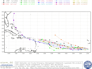
t is just a matter of time before invest 90L will become a tropical storm. Data and satellite images indicate that invest 90L is already a tropical depression, but its center is still exposed. Until that center closes completely, no classification will be official. On that note, I believe that invest 90L will become a tropical storm by Sunday the latest and a hurricane by Tuesday. It is kind of hard to make these predictions since it is not even a storm yet, but this wave has the potential to do so once it gets its act together. Models have consistently, for now, been indicating that invest 90L will be a hurricane off the Southern Bahamas in 8 days (August 22).  

NOTHING is for sure, but we do have to follow and track this wave. Computer models are developing the wave and it hasn't even become a storm yet. Like I have said, once the wave develops and the computer models get a better hold of the wave, then let's see what they have to say. For now, have been very consistent with landfall being anywhere from Louisiana to NorthCarolina. I have seen model runs that make landfall anywhere in between. The only thing that is consistent, but not guaranteed, is landfall in this area. I will try and send updates throughout the weekend if anything important arises. Attached are spaghetti models as of today. It is kind of impressive how the models are so tightly clustered all the way thru 7-8 days away AND not even developed. Let see what happens throughout the weekend.

UPDATE

Sorry I did not send an update this morning. Expect one by 4:30 PM.


The Hurricane Center @ Enrique6News

Thursday, August 13, 2009

Afternoon Tropical Update

Hello everyone. The only thing that is new is that as of the 5 PM update from the NHC, TD #2 has been downgraded to a low (wave). The NHC will continue to monitor the wave in case of any regeneration from the wave. As of now, TD #2 is dead. As for Invest 90L, nothing is new. It continues to try and get its act together. The models continue to make this wave a tropical storm and then a hurricane by Sunday/Monday. Stay tuned for another update tomorrow morning.

Please Vote For Us !!

Please vote for us. Thanks for your help. Our picture is the one titled "The Golden Girls".
 

Morning Tropical Update

Nothing new to report on TD #2 or the tropical wave. TD #2 is very weak and disorganized. Wouldn't be surprised if by 5 pm it loses its tropical depression title. Tropical wave #3 has been designated Invest 90L. That only means that it is an area of investigation. That wave is still a bit disorganized, but that is due to its huge size. Models still want to develop invest 90L into a tropical storm in the coming days and a hurricane by early next week. Everything the models are saying is just for guidance. The wave has to become something for the models to mean anything. It is like saying John (sorry if someone has a family member with that name) is going to die in 2090. How about we wait until John gets sick and then talk about what the doctors and test results say. Not a good analogy, but couldn't think of a better one. Sorry. Let's wait until the wave turns into a depression or a tropical storm. Then let's see what the models say. Have a great day. Stay tuned for more news later.

Wednesday, August 12, 2009

TD #2 = Tropical Storm Ana ??

There are certain numbers that experts use to be able to classify a storm without being able to fly into it and using satellites - Dvorak numbers. Currently, the Dvorak numbers for TD #2 are at 2.5 and that translates into Tropical Storm strength. It has been at 2.5 since 7:15 AM and continues to be at that level. IMHO (in my humble opinion), I believe that the NHC will classify TD#2 as TS Ana for the 5 PM advisory.

In the 11 AM discussion, the NHC did mention that the numbers indicate that TD #2 is a TS but that circulation was not completely closed yet. If Ana does not get classified at 5 PM as TS, that would be the reason.

Let's see.

Special Advisory

A vigorous tropical wave, as labeled by the National Hurricane Center, is producing a large area of showers and thunderstorms near the coast of western Africa this morning. The wave was upgrade earlier today from a less than 30%(code yellow) to 30%-50% (code orange). Conditions appear to be very conducive for development for the next week. It is possible that this wave can travel the whole Atlantic in the next 10 days. I expect this tropical wave to be classified as a Invest sometime today or at the latest tomorrow. Some models are developing this system into a
major hurricane by next week. The latest European model run (ECMWF) is showing the wave as a hurricane located in the Southern Bahamas by next Friday (August 21). Models are not used to say, "a hurricane will hit here." They are mostly used to see trends and consistency in the atmosphere. Also, models this far out are less accurate; so please don't be worried, but vigilant in the coming days.

Below are some concerns from a weather guy about the African wave:

1. The forecast shear maps are showing a large high pressure system developing over this system and moving in sync with it, which would create a very favorable environment for development and intensification over the next several days, at least.

2. It is at a low enough latitude to potentially make this a long tracked storm that could make it all the way to the US coastline. This is NOT a sure thing, but it is a possibility.

3. It is already showing signs of a mid-level circulation and it does have plenty of moisture to work with.

Experts are also saying that TD #2 will end up moistening the environment, move out the Saharan dust from the path, and creating a very favorable environment for development for the disturbance. The reason I am sending this is because when you watch the news tonight the meteorologists are going to mention the fact that the wave is at "code orange". They will say that the wave is 10-12 days away. Models are not set in stone so time will tell. I like to be realistic and know all the possible scenarios before it happens.

Stay tuned for the latest information on TD #2 and the tropical wave off of Africa.

TD #2 - Update 2

Good morning !! Nothing much has changed with tropical depression #2. It looks like a nice ball, but that is deceiving because most of the convection is on the east side of the storm. While it looks very nicely n satellite, convection has not wrapped completely around the center. Having said that, the tropical depression has not strengthen yet, but is expected to be a tropical storm sometime today or early tomorrow. Models still predict that it will continue to head west for a couple more days and then start to move WNW. At that point, TD #2 will slightly curve away from land and into the ocean. Attached is the tracking chart from the NHC. If anything changes during any of the advisories (11 AM and 5 PM), I will let you know. Stay tuned to Enrique6News for your hurricane season coverage.


P.S. – The National Hurricane Center has designated a "vigorous tropical wave" that came off Africa yesterday with a less than 30% chance of developing into a tropical system. I have been seen this wave for a couple of days now in computer models and I would say, based on what the models say, this storm will develop. More info on this later.


Have a great day !!

[Image of 5-day forecast and coastal areas under a warning or a watch]

Tuesday, August 11, 2009

TD #2

The second tropical depression has formed far out in the Atlantic. This is the wave that came off the coast a few days ago. Experts believe that the storm will develop into a tropical storm in 24 to 48 hours. Early predictions indicate that the storm will go west for a couple of days and then start a WNW track which might lead to a curve out into the Atlantic by Sunday. The reason for the curve is due to a possible weakness in the high pressure farther into the forecast track. These models are not that accurate the farther you go from the present so things can change. If the storm takes a farther north track than the one currently predicted By the National Hurricane Center (NHC), it will encounter winds that will inhibit its development. If the storm takes a farther track to the south, it strengthen more than the expected tropical storm prediction the NHC currently believes it will reach by Sunday. A lot can still happen with this system. It came off Africa very strong and ominous, but then looked very ragged yesterday. Now today, it is a tropical depression. Stay tuned to this group and you will receive updates as they are required. If nothing changes throughout the day my next update will be later tonight.

Monday, August 10, 2009

Invest 99L

It seems that there is a strong tropical wave far out in the Atlantic close to Africa. It is that part of the season when waves come off Africa and develop into Tropical Storms and/or Hurricanes and MAYBE affect the U.S.. A lot of the times, as is the assumption with this wave, that these systems curve into "no man's land" and just become a treat to the fishing lanes way up north. It is way too early to tell if this will happen with the tropical wave, but time will tell.

Yesterday, according to some of the meteorological numbers it could have been classified as a Depression, but it lacked a closed circulation. It looked nicely symmetrical, but his morning it is not. With that said, the storm is still in its early stages of development and about 10-12 days away from the U.S. if it makes it that far. I will give you guys another update tomorrow OR today if the wave is classified as a Tropical Depression.

On a side note, Typhoon Morakat hit China yesterday morning as a tropical storm bringing very heavy rain. In Taiwan, according to news reports, more than 80 inches of rain fell over a 2 day period. The world record for rainfall in that span is 98.4 inches. WOW !! The highest one day total in Taiwan occurred on Saturday - 55 inches of rain. Nine of the ten highest one day rain totals in Taiwanese history occurred on Saturday according to the weather bureau. There was 8.78 inches of rainfall in the month of July in Miami-Dade county. Just to give you an idea of how much rain that is.

Have a nice day !!

P.S. - Don't forget to follow my group on Facebook - Tropical Weather
Updates.

Thursday, May 28, 2009

Tropical Depression #1

Welcome to another hurricane season brought to you by the Enrique6 News
- Hurricane Center. I was incredibly surprised when my National
Hurricane Center folder in Outlook lit up. I said, "HUH" ?? I thought at
first it was probably an email since the season is starting in June. It
wasn't !! There is a tropical depression off the coast of Delaware and
it poses no threat to land. It is scheduled to dissipate in a day or
two.

<http://www.nhc.noaa.gov/?5-daynl#contents>

*** This communication has been sent from World Fuel Services
Corporation or its subsidiaries or its affiliates for the intended recipient
only and may contain proprietary, confidential or privileged information.
If you are not the intended recipient, any review, disclosure, copying,
use, or distribution of the information included in this communication
and any attachments is strictly prohibited. If you have received this
communication in error, please notify us immediately by replying to this
communication and delete the communication, including any
attachments, from your computer. Electronic communications sent to or
from World Fuel Services Corporation or its subsidiaries or its affiliates
may be monitored for quality assurance and compliance purposes.***